| Item Detail |
| |
| |
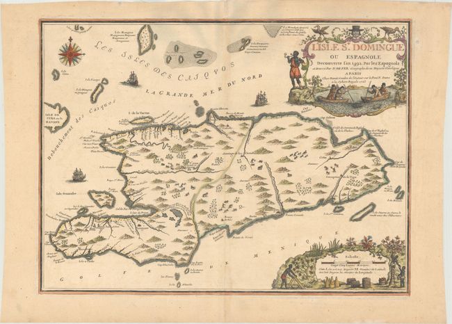
MapMaker: |
Nicolas de Fer
|
|
| |
| |
Subject: |
Hispaniola |
|
| |
Period/Size: |
1723 / 17.2" x 23.2" (43.7 x 59.0 cm)
|
|
| |
Color: |
Colored
|
|
| |
Condition: |
(B+) A nice impression with attractive color on paper with a large rosary beads watermark and very light soiling. (condition help) |
|
| |
Source: |
Atlas ou Recueil de Cartes Geographiques |
|
| |
References: |
Pastoureau, FER II C [96 bis]. |
|
| |
|
|
| Sales Information |
| |
| |
Price: |
|
|
| |
| |
Offered by: |
Old World Auctions |
|
| |
Catalog: |
Auction No. 177 - Antique Maps, Charts, Atlases & Globes (9498) |
|
| |
Lot/Item #: |
304 |
|
| |
| |
Date: |
04/2020
|
|
| |
| |
|