Title:
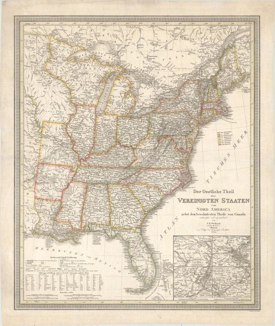
“Der Oestliche Theil der Vereinigten Staaten von Nord America Nebst dem Bewohntesten Theile von Canada”
Map Maker:
Carl Ferdinand Weiland
This detailed map of the United States gives excel... (full text available to subscribers)
| Item Detail |
| |
| |
MapMaker: |
Carl Ferdinand Weiland
|
|
| |
| |
Subject: |
Eastern United States |
|
| |
Period/Size: |
1835 / 24.3" x 20.4" (61.8 x 51.9 cm)
|
|
| |
Color: |
Colored
|
|
| |
Condition: |
(B+) Contemporary outline color with overall creasing that has been pressed flat and is only lightly visible. There is minor soiling and several tears confined to the blank margins that have been archivally repaired. (condition help) |
|
| |
Source: |
Allgemeiner Hand Atlas |
|
| |
References: |
|
|
| |
|
|
| Sales Information |
| |
| |
Price: |
|
|
| |
| |
Offered by: |
Old World Auctions |
|
| |
Catalog: |
Auction No. 177 - Antique Maps, Charts, Atlases & Globes (9498) |
|
| |
Lot/Item #: |
121 |
|
| |
| |
Date: |
04/2020
|
|
| |
| |
|
Antique Maps - Valuation and Pricing, Descriptions, Resources |
|
Home |
Information |
Search |
Register |
Contact Us |
Site Map
Americana Exchange, Inc. © 1999 - 2024 Americana Exchange, Inc.. All rights reserved.
OldMaps.com, the OldMaps.com logo and
AMPR are service marks or registered service marks of Americana Exchange, Inc..
|