Title:
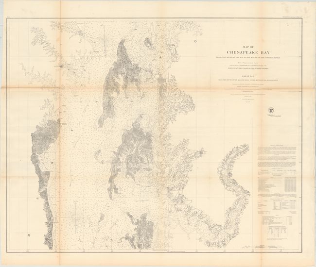
“Map of Chesapeake Bay from the Head of the Bay to the Mouth of the Potomac River ... Sheet No. 2 from the Mouth of the Magothy River to the Mouth of the Hudson River”
Map Maker:
U.S. Coast Survey
This large and detailed chart covers the northern ... (full text available to subscribers)
| Item Detail |
| |
| |
MapMaker: |
U.S. Coast Survey
|
|
| |
| |
Subject: |
Chesapeake Bay, Maryland |
|
| |
Period/Size: |
1857 / 29.6" x 37.3" (75.2 x 94.8 cm)
|
|
| |
Color: |
Black & White
|
|
| |
Condition: |
(B+) Issued folding and now flattened and backed with tissue. There is light toning along the fold lines and a hint of offsetting. (condition help) |
|
| |
Source: |
|
|
| |
References: |
|
|
| |
|
|
| Sales Information |
| |
| |
Price: |
|
|
| |
| |
Offered by: |
Old World Auctions |
|
| |
Catalog: |
Auction No. 177 - Antique Maps, Charts, Atlases & Globes (9498) |
|
| |
Lot/Item #: |
134 |
|
| |
| |
Date: |
04/2020
|
|
| |
| |
|
Antique Maps - Valuation and Pricing, Descriptions, Resources |
|
Home |
Information |
Search |
Register |
Contact Us |
Site Map
Americana Exchange, Inc. © 1999 - 2024 Americana Exchange, Inc.. All rights reserved.
OldMaps.com, the OldMaps.com logo and
AMPR are service marks or registered service marks of Americana Exchange, Inc..
|