Title:
“Annual Report of the United States Geological and Geographical Survey of the Territories, Embracing Colorado...”
Map Maker:
Ferdinand Vandeveer Hayden
This is the Seventh Report from the seminal... (full text available to subscribers)
| Item Detail |
| |
| |
MapMaker: |
Ferdinand Vandeveer Hayden
|
|
| |
| |
Subject: |
Colorado |
|
| |
Period/Size: |
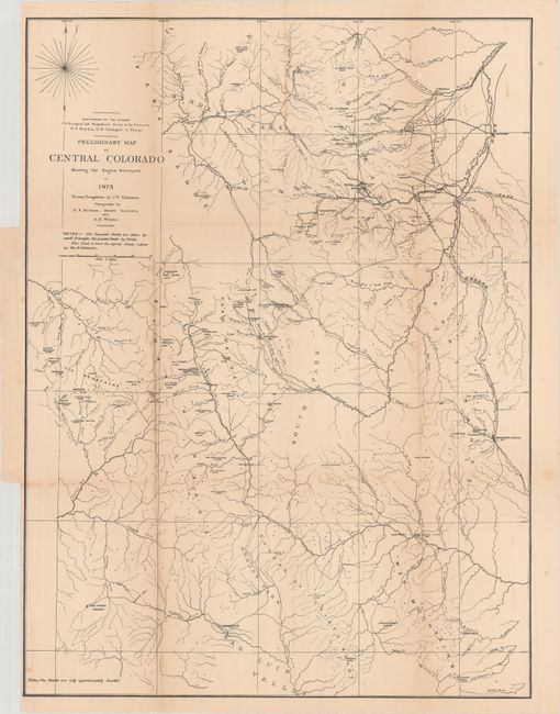
1874 / 9.0" x 6.0" (22.9 x 15.3 cm)
|
|
| |
Color: |
Black & White
|
|
| |
Condition: |
(B+) Condition code is for the contents. The folding map of central Colorado is detached with light toning and a few spots of foxing. The other plates/text are very good to near fine with occasional toning, and a faint dampstain is confined to the right (condition help) |
|
| |
Source: |
|
|
| |
References: |
Wheat (TMW) #1239. |
|
| |
|
|
| Sales Information |
| |
| |
Price: |
|
|
| |
| |
Offered by: |
Old World Auctions |
|
| |
Catalog: |
Auction No. 177 - Antique Maps, Charts, Atlases & Globes (9498) |
|
| |
Lot/Item #: |
186 |
|
| |
| |
Date: |
04/2020
|
|
| |
| |
|
Antique Maps - Valuation and Pricing, Descriptions, Resources |
|
Home |
Information |
Search |
Register |
Contact Us |
Site Map
Americana Exchange, Inc. © 1999 - 2024 Americana Exchange, Inc.. All rights reserved.
OldMaps.com, the OldMaps.com logo and
AMPR are service marks or registered service marks of Americana Exchange, Inc..
|