Title:
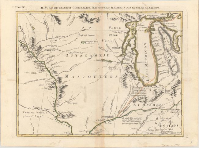
“Il Paese de' Selvaggi Outagamiani, Mascoutensi, Illinesi, e Parte delle VI. Nazioni”
Map Maker:
Antonio Zatta
This is one sheet of Zatta's version of John Mitch... (full text available to subscribers)
| Item Detail |
| |
| |
MapMaker: |
Antonio Zatta
|
|
| |
| |
Subject: |
Colonial Central United States |
|
| |
Period/Size: |
1778 / 12.5" x 16.6" (31.8 x 42.2 cm)
|
|
| |
Color: |
Colored
|
|
| |
Condition: |
(B+) A crisp impression with contemporary color on a bright sheet with a three crescent moons watermark. There is light toning along the centerfold and minor soiling. There are some worm tracks that are mostly confined to the blank margins that have bee (condition help) |
|
| |
Source: |
Atlante Novissimo |
|
| |
References: |
Sellers and Van Ee #163; Shirley (BL Atlases) T.ZAT-1a, Vol. 4 #28. |
|
| |
|
|
| Sales Information |
| |
| |
Price: |
|
|
| |
| |
Offered by: |
Old World Auctions |
|
| |
Catalog: |
Auction No. 177 - Antique Maps, Charts, Atlases & Globes (9498) |
|
| |
Lot/Item #: |
147 |
|
| |
| |
Date: |
04/2020
|
|
| |
| |
|
Antique Maps - Valuation and Pricing, Descriptions, Resources |
|
Home |
Information |
Search |
Register |
Contact Us |
Site Map
Americana Exchange, Inc. © 1999 - 2024 Americana Exchange, Inc.. All rights reserved.
OldMaps.com, the OldMaps.com logo and
AMPR are service marks or registered service marks of Americana Exchange, Inc..
|