| Item Detail |
| |
| |
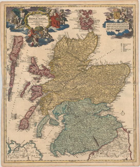
MapMaker: |
Johann Baptist Homann
|
|
| |
| |
Subject: |
Scotland |
|
| |
Period/Size: |
1716 / 22.5" x 18.8" (57.2 x 47.8 cm)
|
|
| |
Color: |
Colored
|
|
| |
Condition: |
(A) A nice impression with contemporary color in the map and later color in the cartouches. There are printer's creases just below the centerfold at far right and left, very minor soiling, and light toning along the edges of the sheet. (condition help) |
|
| |
Source: |
|
|
| |
References: |
|
|
| |
|
|
| Sales Information |
| |
| |
Price: |
|
|
| |
| |
Offered by: |
Old World Auctions |
|
| |
Catalog: |
Auction No. 177 - Antique Maps, Charts, Atlases & Globes (9498) |
|
| |
Lot/Item #: |
385 |
|
| |
| |
Date: |
04/2020
|
|
| |
| |
|