Title:
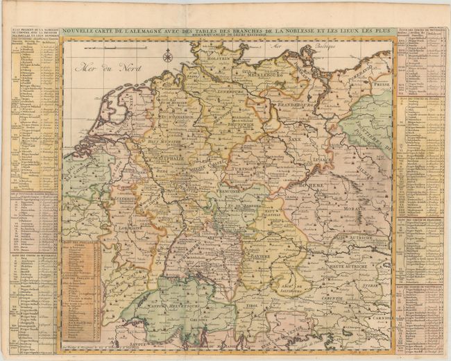
“Nouvelle Carte de l'Alemagne avec des Tables des Branches de la Noblesse et les Lieux les Plus Remarquables de Leurs Residance”
Map Maker:
Henry Abraham Chatelain
Attractive map of the German empire flanked with p... (full text available to subscribers)
| Item Detail |
| |
| |
MapMaker: |
Henry Abraham Chatelain
|
|
| |
| |
Subject: |
Central Europe, Germany |
|
| |
Period/Size: |
1720 / 18.4" x 24.4" (46.8 x 62.0 cm)
|
|
| |
Color: |
Colored
|
|
| |
Condition: |
(A) A crisp impression on a bright sheet with a tiny hole at the fold intersection. (condition help) |
|
| |
Source: |
Atlas Historique |
|
| |
References: |
|
|
| |
|
|
| Sales Information |
| |
| |
Price: |
|
|
| |
| |
Offered by: |
Old World Auctions |
|
| |
Catalog: |
Auction No. 177 - Antique Maps, Charts, Atlases & Globes (9498) |
|
| |
Lot/Item #: |
460 |
|
| |
| |
Date: |
04/2020
|
|
| |
| |
|
Antique Maps - Valuation and Pricing, Descriptions, Resources |
|
Home |
Information |
Search |
Register |
Contact Us |
Site Map
Americana Exchange, Inc. © 1999 - 2024 Americana Exchange, Inc.. All rights reserved.
OldMaps.com, the OldMaps.com logo and
AMPR are service marks or registered service marks of Americana Exchange, Inc..
|