| Item Detail |
| |
| |
MapMaker: |
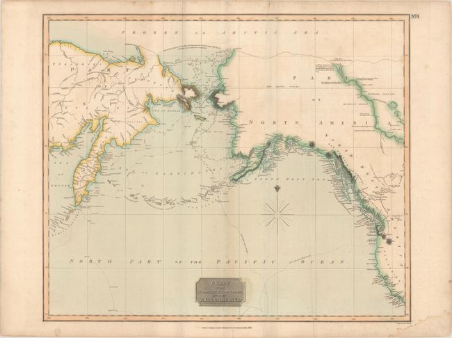
John Thomson [& Co.]
|
|
| |
| |
Subject: |
North Pacific Ocean |
|
| |
Period/Size: |
1816 / 19.4" x 23.3" (49.3 x 59.2 cm)
|
|
| |
Color: |
Colored
|
|
| |
Condition: |
(B+) A nice impression with contemporary color, some extraneous creasing, very light offsetting, and minor soiling. There are a couple of archivally repaired tears along the edges of the sheet and a damp stain confined to the bottom right margin. (condition help) |
|
| |
Source: |
Thomson's New General Atlas |
|
| |
References: |
|
|
| |
|
|
| Sales Information |
| |
| |
Price: |
|
|
| |
| |
Offered by: |
Old World Auctions |
|
| |
Catalog: |
Auction No. 177 - Antique Maps, Charts, Atlases & Globes (9498) |
|
| |
Lot/Item #: |
718 |
|
| |
| |
Date: |
04/2020
|
|
| |
| |
|