| Item Detail |
| |
| |
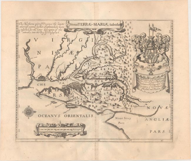
MapMaker: |
John Ogilby
|
|
| |
| |
Subject: |
Colonial Mid-Atlantic United States, Maryland |
|
| |
Period/Size: |
1671 / 11.6" x 14.8" (29.5 x 37.6 cm)
|
|
| |
Color: |
Black & White
|
|
| |
Condition: |
(A) A crisp impression with a fleur-de-lis coat of arms watermark. There are a few faint spots and the paper is slightly rippled, otherwise fine. (condition help) |
|
| |
Source: |
America |
|
| |
References: |
Burden #240; Shirley (BL Atlases) T.OGIL-2a #7. |
|
| |
|
|
| Sales Information |
| |
| |
Price: |
|
|
| |
| |
Offered by: |
Old World Auctions |
|
| |
Catalog: |
Auction No. 177 - Antique Maps, Charts, Atlases & Globes (9498) |
|
| |
Lot/Item #: |
129 |
|
| |
| |
Date: |
04/2020
|
|
| |
| |
|