| Item Detail |
| |
| |
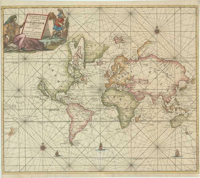
MapMaker: |
Johannes van Keulen
|
|
| |
| |
Subject: |
World |
|
| |
Period/Size: |
1697 / 20.2" x 23.7" (51.3 x 60.2 cm)
|
|
| |
Color: |
Colored
|
|
| |
Condition: |
(B+) A dark impression on a bright sheet with contemporary color that has been refreshed. There are professional repairs to a tiny tear in Greenland, a 1/4" hole at top right, and several small worm holes. The sheet has been professionally de-acidified (condition help) |
|
| |
Source: |
De Nieuwe Groote Lichtende Zee-Fakkel 't Tweede Deel... |
|
| |
References: |
Shirley #512; Wagner #444; Shirley (BL Atlases) #M.KEU-2d #1. |
|
| |
|
|
| Sales Information |
| |
| |
Price: |
|
|
| |
| |
Offered by: |
Old World Auctions |
|
| |
Catalog: |
Auction No. 177 - Antique Maps, Charts, Atlases & Globes (9498) |
|
| |
Lot/Item #: |
4 |
|
| |
| |
Date: |
04/2020
|
|
| |
| |
|