| Item Detail |
| |
| |
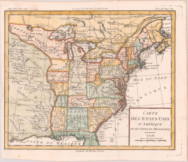
MapMaker: |
Louis Brion de la Tour
|
|
| |
| |
Subject: |
Eastern United States, Franklin |
|
| |
Period/Size: |
1783 / 8.7" x 10.6" (22.1 x 27.0 cm)
|
|
| |
Color: |
Colored
|
|
| |
Condition: |
(A) Issued folding, now flat, with minor offsetting, and a tiny binding tear in the left blank margin that has been archivally repaired on verso. A couple of tiny worm holes have been infilled with archival materials. (condition help) |
|
| |
Source: |
Histoire Universelle |
|
| |
References: |
Dotson & Baker (OWA) #4; Baynton-Williams (TMC-72) #3. |
|
| |
|
|
| Sales Information |
| |
| |
Price: |
|
|
| |
| |
Offered by: |
Old World Auctions |
|
| |
Catalog: |
Auction No. 178 - Antique Maps, Charts, Atlases & Globes (9499) |
|
| |
Lot/Item #: |
107 |
|
| |
| |
Date: |
06/2020
|
|
| |
| |
|