Title:
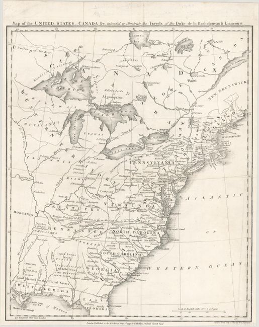
“Map of the United States, Canada &c. Intended to Illustrate the Travels of the Duke de la Rochefoucault Liancourt”
Map Maker:
Francois Alexander de La Rochefoucald-Liancourt
This very uncommon map depicts the nascent United ... (full text available to subscribers)
| Item Detail |
| |
| |
MapMaker: |
Francois Alexander de La Rochefoucald-Liancourt
|
|
| |
| |
Subject: |
Eastern United States & Canada, Franklin |
|
| |
Period/Size: |
1799 / 15.9" x 13.3" (40.4 x 33.8 cm)
|
|
| |
Color: |
Black & White
|
|
| |
Condition: |
(A) A nice impression, issued folding with an extraneous crease at right and archival repairs to a short tear at right and a tiny split at one of the fold intersections. (condition help) |
|
| |
Source: |
Travels Through the United States |
|
| |
References: |
Dotson & Baker (OWA) #14.2; Baynton-Williams #11; McCorkle #799.9; Sabin #39057. |
|
| |
|
|
| Sales Information |
| |
| |
Price: |
|
|
| |
| |
Offered by: |
Old World Auctions |
|
| |
Catalog: |
Auction No. 178 - Antique Maps, Charts, Atlases & Globes (9499) |
|
| |
Lot/Item #: |
91 |
|
| |
| |
Date: |
06/2020
|
|
| |
| |
|
Antique Maps - Valuation and Pricing, Descriptions, Resources |
|
Home |
Information |
Search |
Register |
Contact Us |
Site Map
Americana Exchange, Inc. © 1999 - 2024 Americana Exchange, Inc.. All rights reserved.
OldMaps.com, the OldMaps.com logo and
AMPR are service marks or registered service marks of Americana Exchange, Inc..
|