| Item Detail |
| |
| |
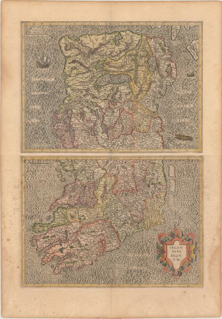
MapMaker: |
Mercator/Hondius
|
|
| |
| |
Subject: |
Ireland |
|
| |
Period/Size: |
1619 / 13.4" x 18.5" (34.1 x 47.0 cm)
|
|
| |
Color: |
Colored
|
|
| |
Condition: |
() Nice impressions on watermarked paper with light toning and marginal damp stains. The northern sheet is in very good condition (B+), and the southern sheet is in good condition (B) due to scattered foxing. The first image is a composite image - the m (condition help) |
|
| |
Source: |
Gerardi Mercatoris - Atlas sive Cosmographicae… |
|
| |
References: |
Law, pp. 19-20; Van der Krogt (Vol. I) #5901:1.1 & #5902:1.1. |
|
| |
|
|
| Sales Information |
| |
| |
Price: |
|
|
| |
| |
Offered by: |
Old World Auctions |
|
| |
Catalog: |
Auction No. 178 - Antique Maps, Charts, Atlases & Globes (9499) |
|
| |
Lot/Item #: |
305 |
|
| |
| |
Date: |
06/2020
|
|
| |
| |
|