Title:
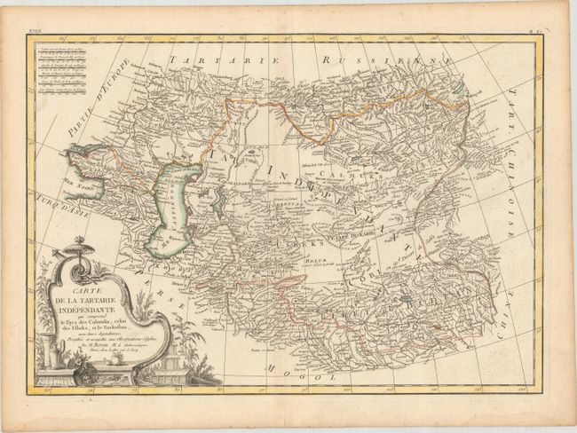
“Carte de la Tartarie Independante qui Comprend le Pays des Calmuks, Celui des Usbeks, et le Turkestan, avec Leurs Dependances...”
Map Maker:
Bonne/Lattre
This beautifully engraved map centers on Uzbekista... (full text available to subscribers)
| Item Detail |
| |
| |
MapMaker: |
Bonne/Lattre
|
|
| |
| |
Subject: |
Central Asia |
|
| |
Period/Size: |
1787 / 12.1" x 17.4" (30.8 x 44.2 cm)
|
|
| |
Color: |
Colored
|
|
| |
Condition: |
(B+) A nice impression with contemporary color on a watermarked sheet. There is a small paper flaw in the image at bottom right, minor toning along the centerfold, and light damp stains along the bottom edge of the sheet. (condition help) |
|
| |
Source: |
Atlas Moderne |
|
| |
References: |
|
|
| |
|
|
| Sales Information |
| |
| |
Price: |
|
|
| |
| |
Offered by: |
Old World Auctions |
|
| |
Catalog: |
Auction No. 178 - Antique Maps, Charts, Atlases & Globes (9499) |
|
| |
Lot/Item #: |
463 |
|
| |
| |
Date: |
06/2020
|
|
| |
| |
|
Antique Maps - Valuation and Pricing, Descriptions, Resources |
|
Home |
Information |
Search |
Register |
Contact Us |
Site Map
Americana Exchange, Inc. © 1999 - 2024 Americana Exchange, Inc.. All rights reserved.
OldMaps.com, the OldMaps.com logo and
AMPR are service marks or registered service marks of Americana Exchange, Inc..
|