Title:
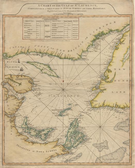
“A Chart of the Gulf of St. Laurence, Composed From a Great Number of Actual Surveys and other Materials, Regulated and Connected by Astronomical Observations”
Map Maker:
Sayer & Bennett
Second state of this handsome sailing chart of the... (full text available to subscribers)
| Item Detail |
| |
| |
MapMaker: |
Sayer & Bennett
|
|
| |
| |
Subject: |
Canada |
|
| |
Period/Size: |
1775 / 22.3" x 19.5" (56.7 x 49.6 cm)
|
|
| |
Color: |
Colored
|
|
| |
Condition: |
(A) A couple of tears in border, repaired with Japanese tissue on verso. (condition help) |
|
| |
Source: |
The American Atlas |
|
| |
References: |
Kershaw #598; Phillips (M) #1166-10. |
|
| |
|
|
| Sales Information |
| |
| |
Price: |
|
|
| |
| |
Offered by: |
Old World Auctions |
|
| |
Catalog: |
Auction No. 97 - Antique Maps, Charts, Atlases & Globes (169) |
|
| |
Lot/Item #: |
119 |
|
| |
| |
Date: |
12/2001
|
|
| |
| |
|
Antique Maps - Valuation and Pricing, Descriptions, Resources |
|
Home |
Information |
Search |
Register |
Contact Us |
Site Map
Americana Exchange, Inc. © 1999 - 2024 Americana Exchange, Inc.. All rights reserved.
OldMaps.com, the OldMaps.com logo and
AMPR are service marks or registered service marks of Americana Exchange, Inc..
|