| Item Detail |
| |
| |
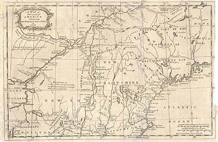
MapMaker: |
Anonymous
|
|
| |
| |
Subject: |
Colonial New England |
|
| |
Period/Size: |
1756 / 8.5" x 13.0" (21.6 x 33.1 cm)
|
|
| |
Color: |
Black & White
|
|
| |
Condition: |
(C) Good impression on hand laid paper. Several tears within the map, all repaired except one small loss of paper affecting the C of Canada and filled with a patch. Archival tape on face of one tear. Would benefit from proper restoration. (condition help) |
|
| |
Source: |
Gentleman's Magazine |
|
| |
References: |
Jolly GENT-102. |
|
| |
|
|
| Sales Information |
| |
| |
Price: |
|
|
| |
| |
Offered by: |
Old World Auctions |
|
| |
Catalog: |
Auction No. 97 - Antique Maps, Charts, Atlases & Globes (169) |
|
| |
Lot/Item #: |
100 |
|
| |
| |
Date: |
12/2001
|
|
| |
| |
|