Title:
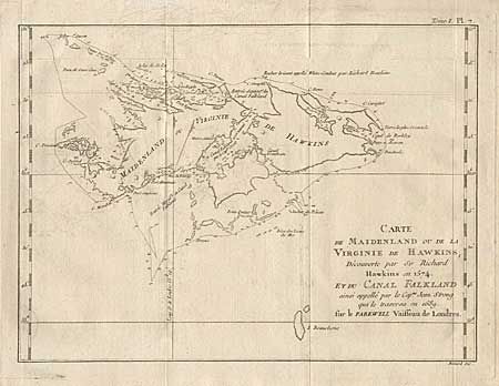
“Carte de Maidenland ou de la Virginie de Hawkins, decouverte par Sir Richard Hawkins en 1574 et du Canal Falkland ainsi appelle par le Cap.ne Jean Strong qui le traverse en 1689”
Map Maker:
Robert Benard
Detailed chart of the Falkland Islands, which were... (full text available to subscribers)
| Item Detail |
| |
| |
MapMaker: |
Robert Benard
|
|
| |
| |
Subject: |
Atlantic |
|
| |
Period/Size: |
1760 / 8.7" x 11.7" (22.1 x 29.8 cm)
|
|
| |
Color: |
Black & White
|
|
| |
Condition: |
(A) Folds as issued. Light offsetting that can be easily erased. (condition help) |
|
| |
Source: |
|
|
| |
References: |
|
|
| |
|
|
| Sales Information |
| |
| |
Price: |
|
|
| |
| |
Offered by: |
Old World Auctions |
|
| |
Catalog: |
Auction No. 97 - Antique Maps, Charts, Atlases & Globes (169) |
|
| |
Lot/Item #: |
281 |
|
| |
| |
Date: |
12/2001
|
|
| |
| |
|
Antique Maps - Valuation and Pricing, Descriptions, Resources |
|
Home |
Information |
Search |
Register |
Contact Us |
Site Map
Americana Exchange, Inc. © 1999 - 2024 Americana Exchange, Inc.. All rights reserved.
OldMaps.com, the OldMaps.com logo and
AMPR are service marks or registered service marks of Americana Exchange, Inc..
|