| Item Detail |
| |
| |
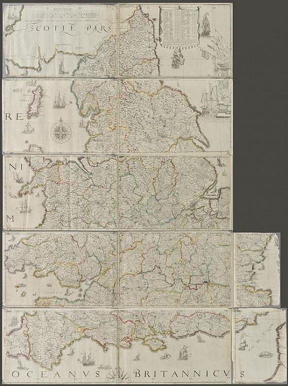
MapMaker: |
SAXTON, Chr. / LEA, P.
|
|
| |
| |
Subject: |
British Isles |
|
| |
Period/Size: |
ca. 1687 / 41.3" x 56.1" (105.0 x 142.5 cm)
|
|
| |
Color: |
Colored
|
|
| |
Condition: |
Generally good condition. 12 (of 14) sheets, is lacking two smaller portions (East coast of Norfolk & Suffolk and South West Cornwall). With a few minor blemishes and some fraying to map strip margins.
It is a large map when combined: approx 1425 mm (condition help) |
|
| |
Source: |
|
|
| |
References: |
R.W.SHirley. Early Printed Maps of the British Isles 1477 - 1650, no.137, state 5. |
|
| |
|
|
| Sales Information |
| |
| |
Price: |
|
|
| |
| |
Offered by: |
Paulus Swaen Old Maps & Prints |
|
| |
Catalog: |
June 2020 Internet Auction (9518) |
|
| |
Lot/Item #: |
98924 |
|
| |
| |
Date: |
06/2020
|
|
| |
| |
|