Title:
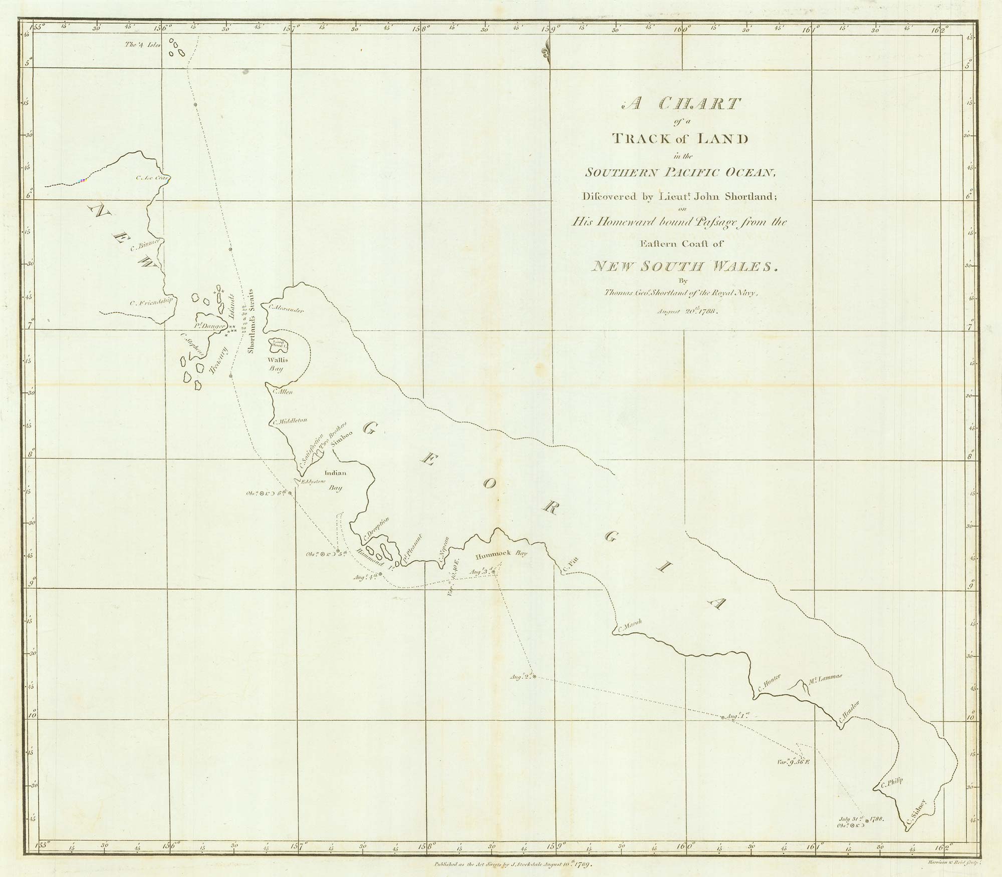
“A Chart of the Track of Land in the Pacific Ocean, Discovered by Lieut.t John Shortland; on His Homeward bound Passage from the Eastern Coast of New South Wales. By Thomas Geo.e Shortland of the Royal Navy, August 20th 1788”
Map Maker:
SHORTLAND, Thomas George.
Chart from the return voyage of a 'First Fleet' sh... (full text available to subscribers)
| Item Detail |
| |
| |
MapMaker: |
SHORTLAND, Thomas George.
|
|
| |
| |
Subject: |
South Pacific Ocean |
|
| |
Period/Size: |
1789 / 15.0" x 5.3" (38.0 x 13.5 cm)
|
|
| |
Color: |
Unknown
|
|
| |
Condition: |
Binding folds flattened (condition help) |
|
| |
Source: |
|
|
| |
References: |
|
|
| |
|
|
| Sales Information |
| |
| |
Price: |
|
|
| |
| |
Offered by: |
Altea Gallery |
|
| |
Catalog: |
New Additions July 2021 (9523) |
|
| |
Lot/Item #: |
21908 |
|
| |
| |
Date: |
07/2021
|
|
| |
| |
|
Antique Maps - Valuation and Pricing, Descriptions, Resources |
|
Home |
Information |
Search |
Register |
Contact Us |
Site Map
Americana Exchange, Inc. © 1999 - 2024 Americana Exchange, Inc.. All rights reserved.
OldMaps.com, the OldMaps.com logo and
AMPR are service marks or registered service marks of Americana Exchange, Inc..
|