Title:
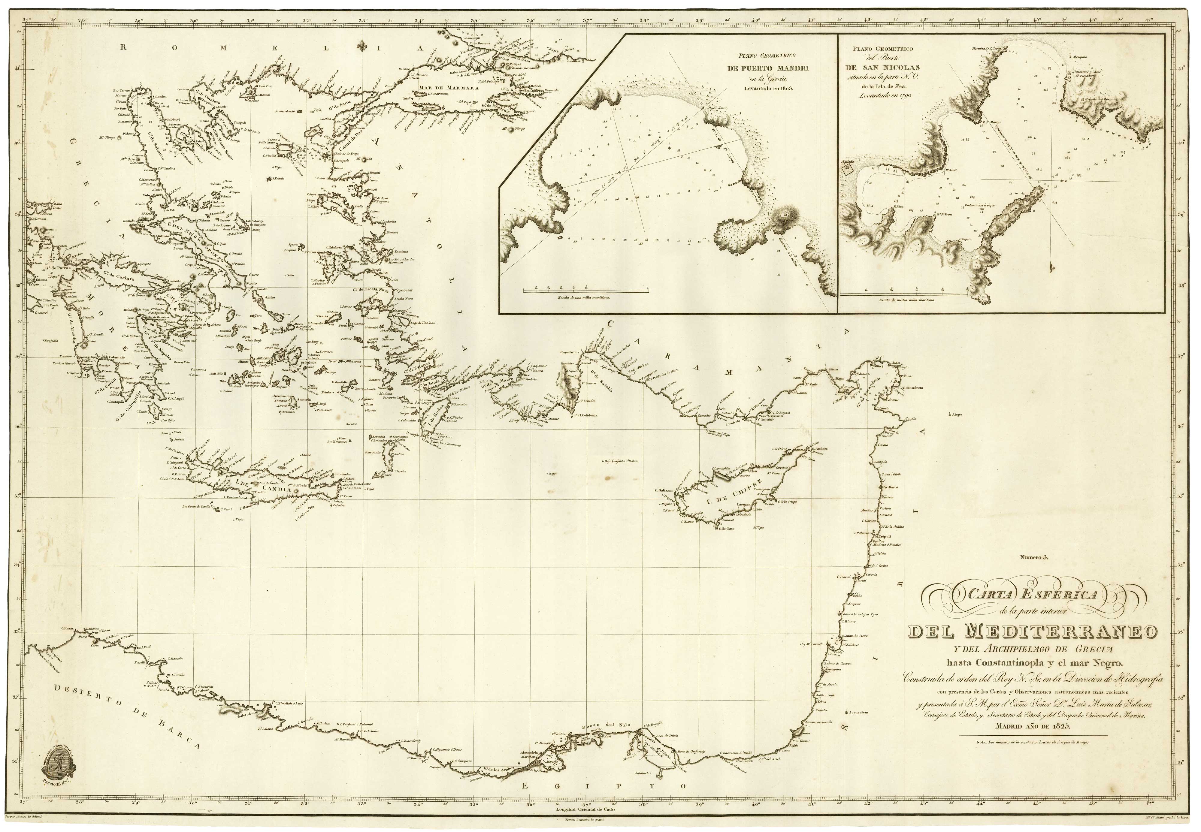
“Carta Esferica de la parte interior del Mediterraneo y del Archipielago de Grecia hasta Constantinopla y el mar Nego.”
Map Maker:
MASSA, Gaspar.
19th century Spanish sea chart of the Eastern Medi... (full text available to subscribers)
| Item Detail |
| |
| |
MapMaker: |
MASSA, Gaspar.
|
|
| |
| |
Subject: |
Eastern Mediterranean |
|
| |
Period/Size: |
1825 / 33.1" x 22.8" (84.0 x 58.0 cm)
|
|
| |
Color: |
Unknown
|
|
| |
Condition: |
Trimmed to printed border on three sides, tear taped. (condition help) |
|
| |
Source: |
|
|
| |
References: |
|
|
| |
|
|
| Sales Information |
| |
| |
Price: |
|
|
| |
| |
Offered by: |
Altea Gallery |
|
| |
Catalog: |
New Additions July 2021 (9523) |
|
| |
Lot/Item #: |
21919 |
|
| |
| |
Date: |
07/2021
|
|
| |
| |
|
Antique Maps - Valuation and Pricing, Descriptions, Resources |
|
Home |
Information |
Search |
Register |
Contact Us |
Site Map
Americana Exchange, Inc. © 1999 - 2024 Americana Exchange, Inc.. All rights reserved.
OldMaps.com, the OldMaps.com logo and
AMPR are service marks or registered service marks of Americana Exchange, Inc..
|