Title:
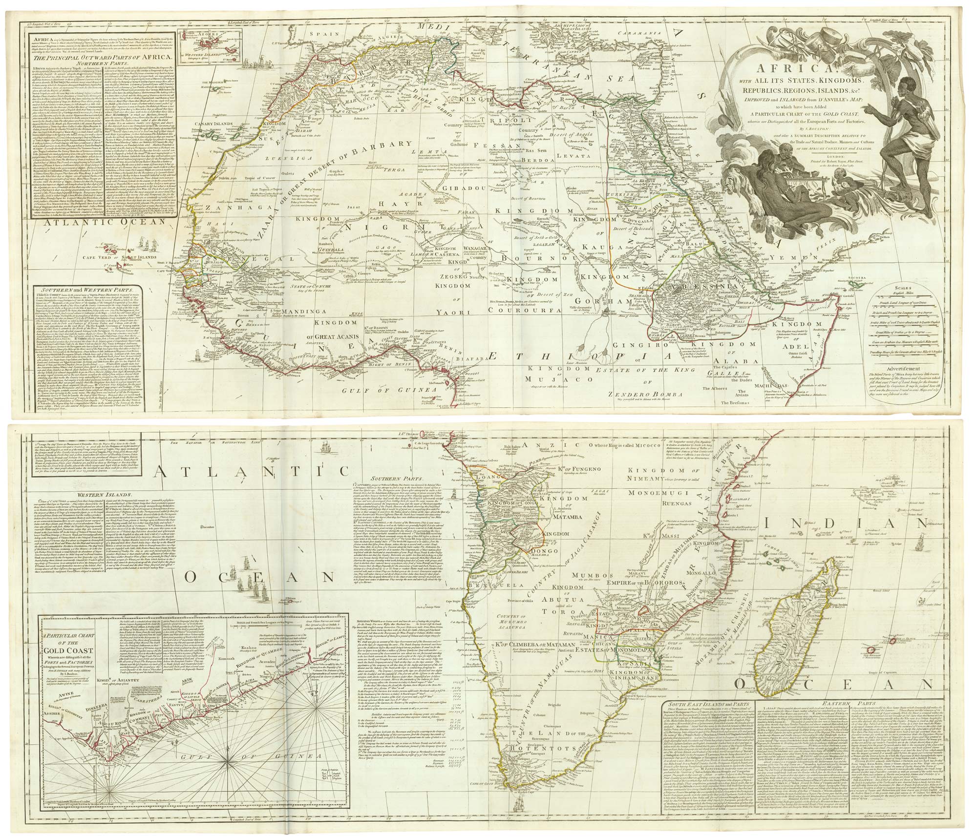
“Africa With All its States, Kingdoms, Republics, Regions, Islands, &c.a Improved and Inlarged from D'Anville's Map; to which have been Added A Particular Chart of the Gold COast, wherein are Distinguished all the European Forts and Factories”
Map Maker:
BOULTON, Solomon.
18th century wall map of Africa
London: Robert Sa... (full text available to subscribers)
| Item Detail |
| |
| |
MapMaker: |
BOULTON, Solomon.
|
|
| |
| |
Subject: |
Africa |
|
| |
Period/Size: |
1787 / 40.6" x 40.9" (103.0 x 104.0 cm)
|
|
| |
Color: |
Unknown
|
|
| |
Condition: |
(condition help) |
|
| |
Source: |
|
|
| |
References: |
See Norwich 105. |
|
| |
|
|
| Sales Information |
| |
| |
Price: |
|
|
| |
| |
Offered by: |
Altea Gallery |
|
| |
Catalog: |
New Additions July 2021 (9523) |
|
| |
Lot/Item #: |
21904 |
|
| |
| |
Date: |
07/2021
|
|
| |
| |
|
Antique Maps - Valuation and Pricing, Descriptions, Resources |
|
Home |
Information |
Search |
Register |
Contact Us |
Site Map
Americana Exchange, Inc. © 1999 - 2024 Americana Exchange, Inc.. All rights reserved.
OldMaps.com, the OldMaps.com logo and
AMPR are service marks or registered service marks of Americana Exchange, Inc..
|