Title:
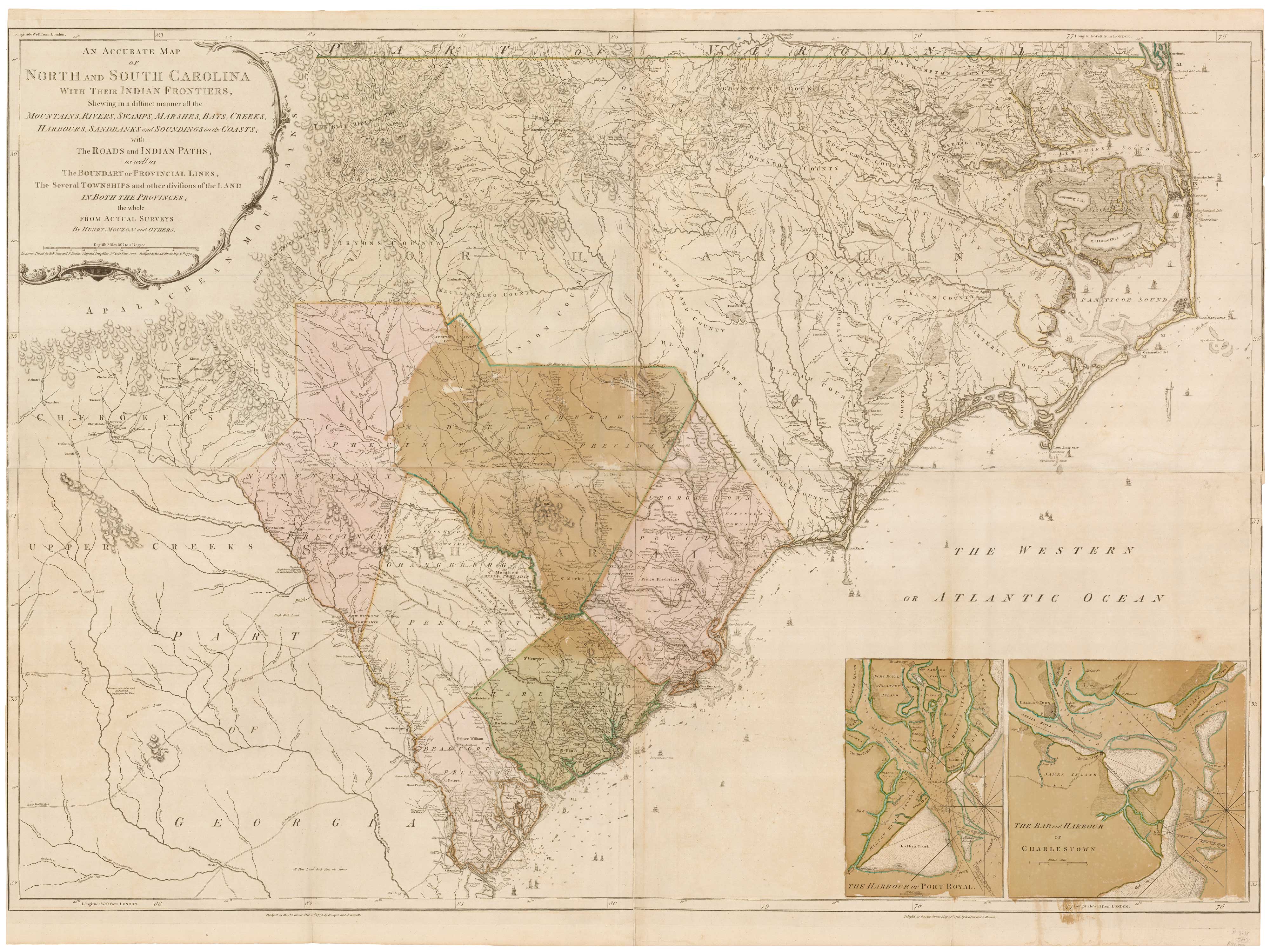
“An Accurate Map of North and South Carolina with their Indian Frontiers, Shewing in a distinct manner all the Mountains, Rivers, Swamps, Marshes, Bays, Creeks, Harbours, Sandbanks and Soundings on the Coasts…”
Map Maker:
MOUZON, William Henry.
Henry Mouzon's landmark 4-sheet map of the Carolin... (full text available to subscribers)
| Item Detail |
| |
| |
MapMaker: |
MOUZON, William Henry.
|
|
| |
| |
Subject: |
Southeast United States |
|
| |
Period/Size: |
1775 / 55.3" x 40.6" (140.5 x 103.0 cm)
|
|
| |
Color: |
Unknown
|
|
| |
Condition: |
Trimmed close to printed borders at sides; a few small repairs, greens slightly oxidised (condition help) |
|
| |
Source: |
|
|
| |
References: |
|
|
| |
|
|
| Sales Information |
| |
| |
Price: |
|
|
| |
| |
Offered by: |
Altea Gallery |
|
| |
Catalog: |
New Additions July 2021 (9523) |
|
| |
Lot/Item #: |
21884 |
|
| |
| |
Date: |
07/2021
|
|
| |
| |
|
Antique Maps - Valuation and Pricing, Descriptions, Resources |
|
Home |
Information |
Search |
Register |
Contact Us |
Site Map
Americana Exchange, Inc. © 1999 - 2024 Americana Exchange, Inc.. All rights reserved.
OldMaps.com, the OldMaps.com logo and
AMPR are service marks or registered service marks of Americana Exchange, Inc..
|