| Item Detail |
| |
| |
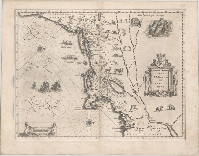
MapMaker: |
Willem Blaeu
|
|
| |
| |
Subject: |
Colonial New England & Mid-Atlantic United States |
|
| |
Period/Size: |
1634 / 15.3" x 19.9" (38.9 x 50.6 cm)
|
|
| |
Color: |
Black & White
|
|
| |
Condition: |
(B+) A crisp impression on a watermarked sheet with expert repairs to a few small separations and tiny holes along the centerfold with one letter ("z") in facsimile. There is light soiling, minor printer's ink residue, and professional repairs to a few e (condition help) |
|
| |
Source: |
Ander Theil Novi Atlantis Das Ist Abbildung und Beschreibung... |
|
| |
References: |
Burden #241; Goss (Blaeu) p. 164; McCorkle #635.1; Van der Krogt (Vol. II) #9310:2. |
|
| |
|
|
| Sales Information |
| |
| |
Price: |
|
|
| |
| |
Offered by: |
Old World Auctions |
|
| |
Catalog: |
Auction No. 179 - Antique Maps, Charts, Atlases & Globes (9525) |
|
| |
Lot/Item #: |
171 |
|
| |
| |
Date: |
09/2020
|
|
| |
| |
|