Title:
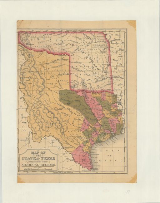
“Map of the State of Texas with Portions of the Adjoining Regions”
Map Maker:
Thomas, Cowperthwait & Co.
This rare map was originally issued on a sh... (full text available to subscribers)
| Item Detail |
| |
| |
MapMaker: |
Thomas, Cowperthwait & Co.
|
|
| |
| |
Subject: |
Texas |
|
| |
Period/Size: |
1846 / 10.3" x 7.8" (26.2 x 19.9 cm)
|
|
| |
Color: |
Colored
|
|
| |
Condition: |
(B) Issued folding and now flattened and backed on paper with "Permanized Parchment" watermark. Narrow left side margin as it was issued on a sheet with another map and then separated. (condition help) |
|
| |
Source: |
Geographical Description Of The State Of Texas |
|
| |
References: |
Rumsey #4482; Streeter #3325; Howes #M688. |
|
| |
|
|
| Sales Information |
| |
| |
Price: |
|
|
| |
| |
Offered by: |
Old World Auctions |
|
| |
Catalog: |
Auction No. 179 - Antique Maps, Charts, Atlases & Globes (9525) |
|
| |
Lot/Item #: |
298 |
|
| |
| |
Date: |
09/2020
|
|
| |
| |
|
Antique Maps - Valuation and Pricing, Descriptions, Resources |
|
Home |
Information |
Search |
Register |
Contact Us |
Site Map
Americana Exchange, Inc. © 1999 - 2024 Americana Exchange, Inc.. All rights reserved.
OldMaps.com, the OldMaps.com logo and
AMPR are service marks or registered service marks of Americana Exchange, Inc..
|