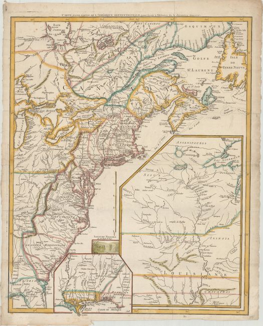
Title:
“Carte d'une Partie de l'Amerique Septentrionale, pour Servir a l'Histoire de la Derniere Guerre”
Map Maker:
George Louis Le Rouge
This interesting map began life in 1755 with the t... (full text available to subscribers)
| Item Detail |
| |
| |
MapMaker: |
George Louis Le Rouge
|
|
| |
| |
Subject: |
Eastern United States & Canada |
|
| |
Period/Size: |
1787 / 24.1" x 19.4" (61.3 x 49.3 cm)
|
|
| |
Color: |
Colored
|
|
| |
Condition: |
(A) Issued folding on watermarked paper with a few faint spots, otherwise fine. (condition help) |
|
| |
Source: |
Histoire des Troubles de l'Amerique Anglaises |
|
| |
References: |
cf. McCorkle #755.23 & #777.14; cf. Sellers and Van Ee #33 & 154. |
|
| |
|
|
| Sales Information |
| |
| |
Price: |
|
|
| |
| |
Offered by: |
Old World Auctions |
|
| |
Catalog: |
Auction No. 179 - Antique Maps, Charts, Atlases & Globes (9525) |
|
| |
Lot/Item #: |
127 |
|
| |
| |
Date: |
09/2020
|
|
| |
| |
|
Antique Maps - Valuation and Pricing, Descriptions, Resources |
|
Home |
Information |
Search |
Register |
Contact Us |
Site Map
Americana Exchange, Inc. © 1999 - 2024 Americana Exchange, Inc.. All rights reserved.
OldMaps.com, the OldMaps.com logo and
AMPR are service marks or registered service marks of Americana Exchange, Inc..
|