| Item Detail |
| |
| |
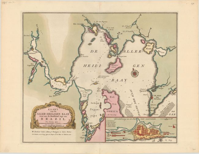
MapMaker: |
Isaac Tirion
|
|
| |
| |
Subject: |
Baia de Todos os Santos, Brazil |
|
| |
Period/Size: |
1769 / 13.4" x 15.9" (34.1 x 40.4 cm)
|
|
| |
Color: |
Colored
|
|
| |
Condition: |
(A+) A crisp impression with full contemporary color on a bright sheet with the watermarks of a fleur-de-lis coat of arms and "Villedary." (condition help) |
|
| |
Source: |
Nieuwe en Beknopte Hand-Atlas |
|
| |
References: |
Shirley (BL Atlases) T.TIR-2a. |
|
| |
|
|
| Sales Information |
| |
| |
Price: |
|
|
| |
| |
Offered by: |
Old World Auctions |
|
| |
Catalog: |
Auction No. 179 - Antique Maps, Charts, Atlases & Globes (9525) |
|
| |
Lot/Item #: |
423 |
|
| |
| |
Date: |
09/2020
|
|
| |
| |
|