Title:
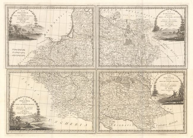
“La Polonia Divisa nelle sue Antiche Province e Delineata sulle Ultime Osservazioni…”
Map Maker:
Giovanni Maria Cassini
This elegantly engraved four-sheet map shows prese... (full text available to subscribers)
| Item Detail |
| |
| |
MapMaker: |
Giovanni Maria Cassini
|
|
| |
| |
Subject: |
Eastern Europe & Baltic |
|
| |
Period/Size: |
1797 / 13.2" x 18.8" (33.6 x 47.8 cm)
|
|
| |
Color: |
Black & White
|
|
| |
Condition: |
() All four sheets are bright with crisp impressions. The first and second sheets are in A condition; the third and fourth sheets are in B+ condition with light damp stains that just enter into the map image at top. The first image is a composite image (condition help) |
|
| |
Source: |
Nuovo Atlante Geografico Universale... |
|
| |
References: |
Phillips (Atlases) #670 Vol. II #67-70. |
|
| |
|
|
| Sales Information |
| |
| |
Price: |
|
|
| |
| |
Offered by: |
Old World Auctions |
|
| |
Catalog: |
Auction No. 179 - Antique Maps, Charts, Atlases & Globes (9525) |
|
| |
Lot/Item #: |
590 |
|
| |
| |
Date: |
09/2020
|
|
| |
| |
|
Antique Maps - Valuation and Pricing, Descriptions, Resources |
|
Home |
Information |
Search |
Register |
Contact Us |
Site Map
Americana Exchange, Inc. © 1999 - 2024 Americana Exchange, Inc.. All rights reserved.
OldMaps.com, the OldMaps.com logo and
AMPR are service marks or registered service marks of Americana Exchange, Inc..
|