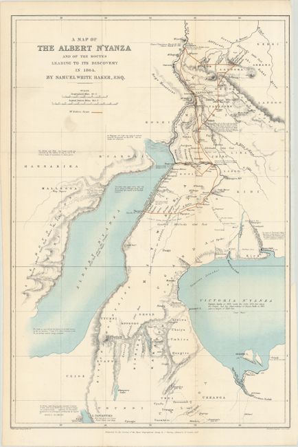
Title:
“A Map of the Albert N'Yanza and of the Routes Leading to Its Discovery in 1864”
Map Maker:
Royal Geographical Society
This detailed map shows the route of Samuel Baker ... (full text available to subscribers)
| Item Detail |
| |
| |
MapMaker: |
Royal Geographical Society
|
|
| |
| |
Subject: |
Eastern Africa |
|
| |
Period/Size: |
1866 / 19.1" x 13.0" (48.6 x 33.1 cm)
|
|
| |
Color: |
Colored
|
|
| |
Condition: |
(A) Issued folding on a bright sheet that is now flattened and backed with tissue. There is a hint of offsetting and a small smudge below the title. (condition help) |
|
| |
Source: |
|
|
| |
References: |
|
|
| |
|
|
| Sales Information |
| |
| |
Price: |
|
|
| |
| |
Offered by: |
Old World Auctions |
|
| |
Catalog: |
Auction No. 179 - Antique Maps, Charts, Atlases & Globes (9525) |
|
| |
Lot/Item #: |
794 |
|
| |
| |
Date: |
09/2020
|
|
| |
| |
|
Antique Maps - Valuation and Pricing, Descriptions, Resources |
|
Home |
Information |
Search |
Register |
Contact Us |
Site Map
Americana Exchange, Inc. © 1999 - 2024 Americana Exchange, Inc.. All rights reserved.
OldMaps.com, the OldMaps.com logo and
AMPR are service marks or registered service marks of Americana Exchange, Inc..
|