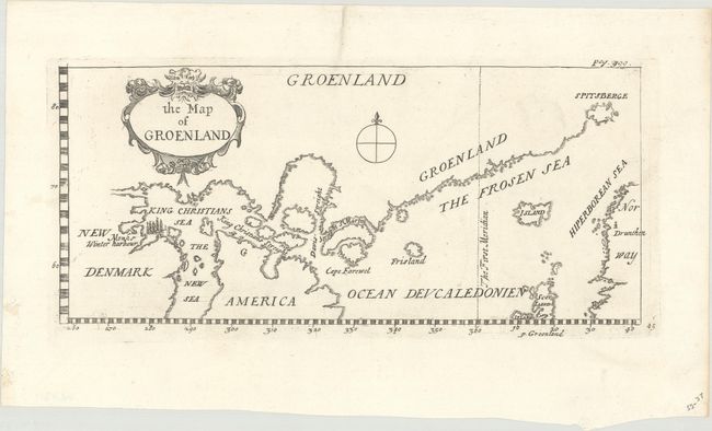
Title:
“The Map of Groenland”
Map Maker:
John Churchill
Interesting map showing a continuous coastline fro... (full text available to subscribers)
| Item Detail |
| |
| |
MapMaker: |
John Churchill
|
|
| |
| |
Subject: |
Greenland & Canada |
|
| |
Period/Size: |
1704 / 4.9" x 11.1" (12.5 x 28.2 cm)
|
|
| |
Color: |
Black & White
|
|
| |
Condition: |
(A+) A crisp impression on a clean bright sheet. (condition help) |
|
| |
Source: |
A Collection of Voyages and Travels |
|
| |
References: |
cf. Burden #285. |
|
| |
|
|
| Sales Information |
| |
| |
Price: |
|
|
| |
| |
Offered by: |
Old World Auctions |
|
| |
Catalog: |
Auction No. 179 - Antique Maps, Charts, Atlases & Globes (9525) |
|
| |
Lot/Item #: |
447 |
|
| |
| |
Date: |
09/2020
|
|
| |
| |
|
Antique Maps - Valuation and Pricing, Descriptions, Resources |
|
Home |
Information |
Search |
Register |
Contact Us |
Site Map
Americana Exchange, Inc. © 1999 - 2024 Americana Exchange, Inc.. All rights reserved.
OldMaps.com, the OldMaps.com logo and
AMPR are service marks or registered service marks of Americana Exchange, Inc..
|