Title:
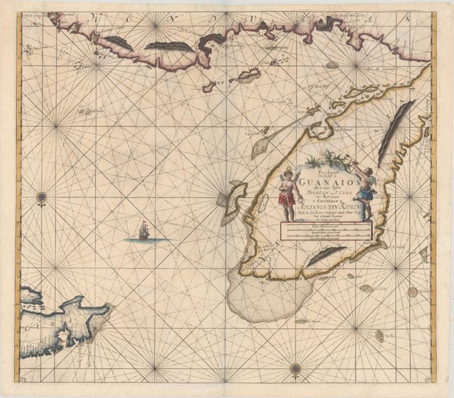
“Pas-kaart van de Golff de Guanaios met 't Canaal Tusschen Yucatan en I. Cuba”
Map Maker:
Johannes van Keulen
This superb sea chart covers the Yucatan Peninsula... (full text available to subscribers)
| Item Detail |
| |
| |
MapMaker: |
Johannes van Keulen
|
|
| |
| |
Subject: |
Gulf of Mexico & Cuba |
|
| |
Period/Size: |
1695 / 20.1" x 22.8" (51.1 x 58.0 cm)
|
|
| |
Color: |
Colored
|
|
| |
Condition: |
(B+) Nice impression and color with light soiling and some creasing and cockling of the paper at top. There is one tiny hole that has been archivally infilled. The grayish shadow along the centerfold is caused by our scanner and doesn't appear on the ma (condition help) |
|
| |
Source: |
Zee-Fakkel |
|
| |
References: |
|
|
| |
|
|
| Sales Information |
| |
| |
Price: |
|
|
| |
| |
Offered by: |
Old World Auctions |
|
| |
Catalog: |
Auction No. 179 - Antique Maps, Charts, Atlases & Globes (9525) |
|
| |
Lot/Item #: |
370 |
|
| |
| |
Date: |
09/2020
|
|
| |
| |
|
Antique Maps - Valuation and Pricing, Descriptions, Resources |
|
Home |
Information |
Search |
Register |
Contact Us |
Site Map
Americana Exchange, Inc. © 1999 - 2024 Americana Exchange, Inc.. All rights reserved.
OldMaps.com, the OldMaps.com logo and
AMPR are service marks or registered service marks of Americana Exchange, Inc..
|