Title:
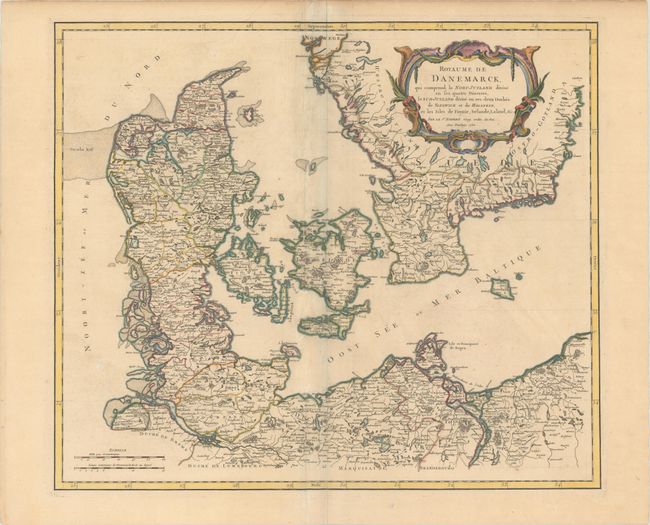
“Royaume de Danemarck, qui Comprend le Nort-Jutland Divise en ses Quatre Dioceses, le Sud-Jutland Divise en ses Deux Duches de Sleswick et de Holstein...”
Map Maker:
Gilles Robert de Vaugondy
This is the first state of this lovely map of Denm... (full text available to subscribers)
| Item Detail |
| |
| |
MapMaker: |
Gilles Robert de Vaugondy
|
|
| |
| |
Subject: |
Denmark |
|
| |
Period/Size: |
1750 / 19.1" x 22.4" (48.6 x 56.9 cm)
|
|
| |
Color: |
Colored
|
|
| |
Condition: |
(B+) Contemporary outline color in the map with later color in the cartouche, on paper with a small chapel watermark. There is light soiling and some creasing along the centerfold. (condition help) |
|
| |
Source: |
Atlas Universel |
|
| |
References: |
Pedley #72. |
|
| |
|
|
| Sales Information |
| |
| |
Price: |
|
|
| |
| |
Offered by: |
Old World Auctions |
|
| |
Catalog: |
Auction No. 179 - Antique Maps, Charts, Atlases & Globes (9525) |
|
| |
Lot/Item #: |
509 |
|
| |
| |
Date: |
09/2020
|
|
| |
| |
|
Antique Maps - Valuation and Pricing, Descriptions, Resources |
|
Home |
Information |
Search |
Register |
Contact Us |
Site Map
Americana Exchange, Inc. © 1999 - 2024 Americana Exchange, Inc.. All rights reserved.
OldMaps.com, the OldMaps.com logo and
AMPR are service marks or registered service marks of Americana Exchange, Inc..
|