| Item Detail |
| |
| |
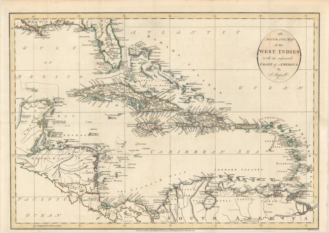
MapMaker: |
John Russell
|
|
| |
| |
Subject: |
Caribbean |
|
| |
Period/Size: |
1794 / 13.9" x 19.8" (35.3 x 50.3 cm)
|
|
| |
Color: |
Colored
|
|
| |
Condition: |
(A) A crisp impression on a bright sheet, issued folding and now flattened with a hint of offsetting and archival repairs to a few tiny fold separations. A binding trim at right has been replaced, and an adjacent 1" binding tear has been archivally repai (condition help) |
|
| |
Source: |
Am American Atlas… |
|
| |
References: |
Phillips (Maps) p. 1059; Phillips (A) p. 751. |
|
| |
|
|
| Sales Information |
| |
| |
Price: |
|
|
| |
| |
Offered by: |
Old World Auctions |
|
| |
Catalog: |
Auction No. 179 - Antique Maps, Charts, Atlases & Globes (9525) |
|
| |
Lot/Item #: |
377 |
|
| |
| |
Date: |
09/2020
|
|
| |
| |
|