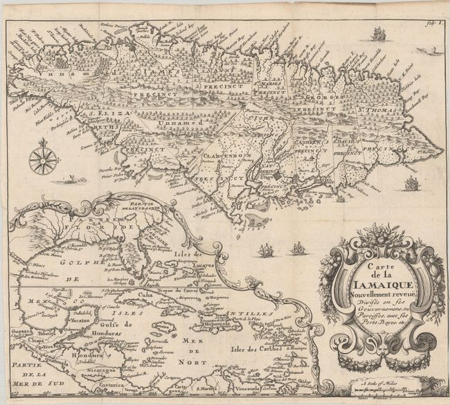
Title:
“Carte de la Iamaique Nouvellement Reveue, Divisee en ses Gouvernemens, ou Paroisses, avec ses Ports, Bayes, Etc.”
Map Maker:
Richard Blome
This uncommon and elegantly engraved map is the Fr... (full text available to subscribers)
| Item Detail |
| |
| |
MapMaker: |
Richard Blome
|
|
| |
| |
Subject: |
Jamaica, Gulf of Mexico & Caribbean |
|
| |
Period/Size: |
1715 / 9.9" x 11.4" (25.2 x 29.0 cm)
|
|
| |
Color: |
Black & White
|
|
| |
Condition: |
(B+) A crisp impression issued folding on watermarked paper that has been trimmed to the border at right. (condition help) |
|
| |
Source: |
Description des Isles et Terres que l'Angleterre Possede en Amerique |
|
| |
References: |
Burden #642; Kapp (MCC-42) #19. |
|
| |
|
|
| Sales Information |
| |
| |
Price: |
|
|
| |
| |
Offered by: |
Old World Auctions |
|
| |
Catalog: |
Auction No. 180 - Antique Maps, Charts, Atlases & Globes (9526) |
|
| |
Lot/Item #: |
340 |
|
| |
| |
Date: |
11/2020
|
|
| |
| |
|
Antique Maps - Valuation and Pricing, Descriptions, Resources |
|
Home |
Information |
Search |
Register |
Contact Us |
Site Map
Americana Exchange, Inc. © 1999 - 2024 Americana Exchange, Inc.. All rights reserved.
OldMaps.com, the OldMaps.com logo and
AMPR are service marks or registered service marks of Americana Exchange, Inc..
|