Title:
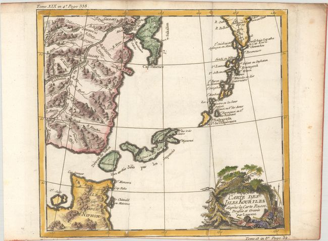
“Carte des Isles Kouriles d'Apres la Carte Russe. Dressee et Gravee par Laurent”
Map Maker:
Jacques Nicolas Bellin
Attractive map of the Kuriles, a chain of volcanic... (full text available to subscribers)
| Item Detail |
| |
| |
MapMaker: |
Jacques Nicolas Bellin
|
|
| |
| |
Subject: |
Kurile Islands & Japan |
|
| |
Period/Size: |
1780 / 9.4" x 10.4" (23.9 x 26.5 cm)
|
|
| |
Color: |
Colored
|
|
| |
Condition: |
(A) A dark impression on a bright sheet of watermarked paper, issued folding with minor offsetting and soiling along the edges of the sheet. Trimmed close to neatline at bottom by bookbinder. (condition help) |
|
| |
Source: |
Abrege de l'Histoire Generale des Voyages |
|
| |
References: |
|
|
| |
|
|
| Sales Information |
| |
| |
Price: |
|
|
| |
| |
Offered by: |
Old World Auctions |
|
| |
Catalog: |
Auction No. 180 - Antique Maps, Charts, Atlases & Globes (9526) |
|
| |
Lot/Item #: |
672 |
|
| |
| |
Date: |
11/2020
|
|
| |
| |
|
Antique Maps - Valuation and Pricing, Descriptions, Resources |
|
Home |
Information |
Search |
Register |
Contact Us |
Site Map
Americana Exchange, Inc. © 1999 - 2024 Americana Exchange, Inc.. All rights reserved.
OldMaps.com, the OldMaps.com logo and
AMPR are service marks or registered service marks of Americana Exchange, Inc..
|