| Item Detail |
| |
| |
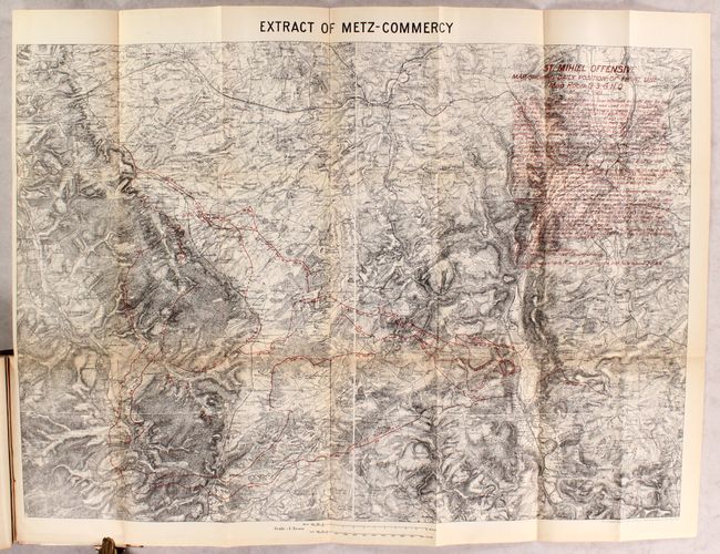
MapMaker: |
U.S. Government Printing Office
|
|
| |
| |
Subject: |
Books, Europe, World War I |
|
| |
Period/Size: |
1919 / 9.4" x 6.0" (23.9 x 15.3 cm)
|
|
| |
Color: |
Colored
|
|
| |
Condition: |
(B+) Folding maps and plates are very good with light toning along fold lines and sheet edges. Text is near fine. Covers are soiled and lightly worn. (condition help) |
|
| |
Source: |
|
|
| |
References: |
|
|
| |
|
|
| Sales Information |
| |
| |
Price: |
|
|
| |
| |
Offered by: |
Old World Auctions |
|
| |
Catalog: |
Auction No. 180 - Antique Maps, Charts, Atlases & Globes (9526) |
|
| |
Lot/Item #: |
397 |
|
| |
| |
Date: |
11/2020
|
|
| |
| |
|