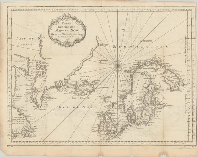
Title:
“Carte Reduite des Mers du Nord pour Servir a l'Histoire Generale des Voyages”
Map Maker:
Jacques Nicolas Bellin
This nice chart is centered roughly on Iceland and... (full text available to subscribers)
| Item Detail |
| |
| |
MapMaker: |
Jacques Nicolas Bellin
|
|
| |
| |
Subject: |
North Atlantic |
|
| |
Period/Size: |
1758 / 13.0" x 17.8" (33.1 x 45.3 cm)
|
|
| |
Color: |
Black & White
|
|
| |
Condition: |
(B+) Issued folding on paper with a bunch of grapes watermark. There is light offsetting and a few spots of foxing concentrated along the folds. A 0.5" edge tear at right has been closed with tape on verso. (condition help) |
|
| |
Source: |
Histoire Generale des Voyages |
|
| |
References: |
|
|
| |
|
|
| Sales Information |
| |
| |
Price: |
|
|
| |
| |
Offered by: |
Old World Auctions |
|
| |
Catalog: |
Auction No. 180 - Antique Maps, Charts, Atlases & Globes (9526) |
|
| |
Lot/Item #: |
387 |
|
| |
| |
Date: |
11/2020
|
|
| |
| |
|
Antique Maps - Valuation and Pricing, Descriptions, Resources |
|
Home |
Information |
Search |
Register |
Contact Us |
Site Map
Americana Exchange, Inc. © 1999 - 2024 Americana Exchange, Inc.. All rights reserved.
OldMaps.com, the OldMaps.com logo and
AMPR are service marks or registered service marks of Americana Exchange, Inc..
|