| Item Detail |
| |
| |
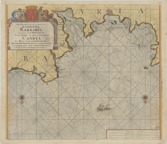
MapMaker: |
Johannes van Keulen
|
|
| |
| |
Subject: |
Libya |
|
| |
Period/Size: |
1680 / 20.0" x 23.1" (50.8 x 58.7 cm)
|
|
| |
Color: |
Colored
|
|
| |
Condition: |
(B+) A dark impression on a sheet with a "CWP" watermark, light printer's ink residue, faint dampstains at the sides, and a couple of tiny chips along the edges of the sheet. (condition help) |
|
| |
Source: |
De Nieuwe Groote Lichtende Zee-Fackel |
|
| |
References: |
|
|
| |
|
|
| Sales Information |
| |
| |
Price: |
|
|
| |
| |
Offered by: |
Old World Auctions |
|
| |
Catalog: |
Auction No. 180 - Antique Maps, Charts, Atlases & Globes (9526) |
|
| |
Lot/Item #: |
713 |
|
| |
| |
Date: |
11/2020
|
|
| |
| |
|