| Item Detail |
| |
| |
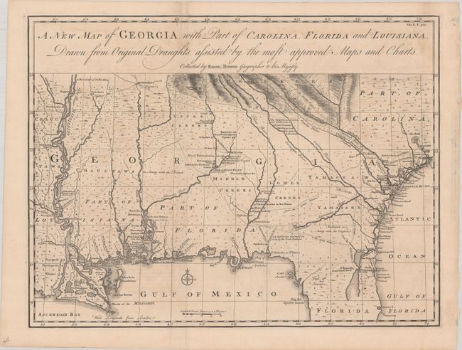
MapMaker: |
Emanuel Bowen
|
|
| |
| |
Subject: |
Colonial Southeastern United States |
|
| |
Period/Size: |
1748 / 14.3" x 18.9" (36.4 x 48.0 cm)
|
|
| |
Color: |
Black & White
|
|
| |
Condition: |
(B+) A crisp impression on watermarked paper, originally issued folding and now pressed flat. There are light dampstains along the border at top, minor toning, and a previous owner's stamp on verso that just shows through in the right blank margin. (condition help) |
|
| |
Source: |
Harris' A Complete Collection of Voyages and Travels... |
|
| |
References: |
Shirley (BL Atlases) G.HARR-1a #20; Cumming (SE) #267; TMC, Issue 19, p.27-31. |
|
| |
|
|
| Sales Information |
| |
| |
Price: |
|
|
| |
| |
Offered by: |
Old World Auctions |
|
| |
Catalog: |
Auction No. 180 - Antique Maps, Charts, Atlases & Globes (9526) |
|
| |
Lot/Item #: |
171 |
|
| |
| |
Date: |
11/2020
|
|
| |
| |
|