| Item Detail |
| |
| |
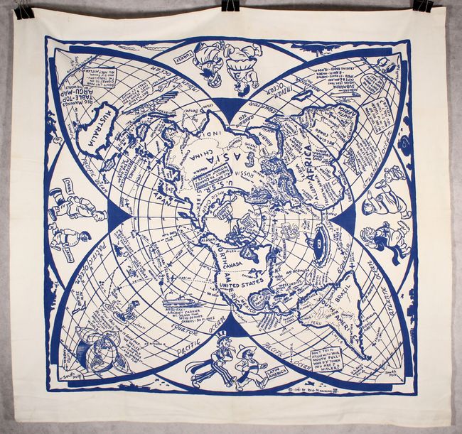
MapMaker: |
Reg Manning
|
|
| |
| |
Subject: |
World, World War II |
|
| |
Period/Size: |
1941 / 42.0" x 42.0" (106.7 x 106.7 cm)
|
|
| |
Color: |
Colored
|
|
| |
Condition: |
(B+) A bright example with a few stains and two small holes - one along the east coast of Africa that has been repaired with white thread and another in the cusp between South America and the South Pacific. (condition help) |
|
| |
Source: |
|
|
| |
References: |
|
|
| |
|
|
| Sales Information |
| |
| |
Price: |
|
|
| |
| |
Offered by: |
Old World Auctions |
|
| |
Catalog: |
Auction No. 180 - Antique Maps, Charts, Atlases & Globes (9526) |
|
| |
Lot/Item #: |
23 |
|
| |
| |
Date: |
11/2020
|
|
| |
| |
|