| Item Detail |
| |
| |
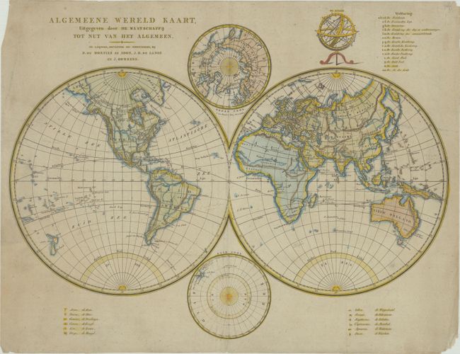
MapMaker: |
Cornelis van Baarsel
|
|
| |
| |
Subject: |
World |
|
| |
Period/Size: |
1810 / 16.0" x 21.6" (40.7 x 54.9 cm)
|
|
| |
Color: |
Colored
|
|
| |
Condition: |
(B+) On a lightly toned sheet with a Strasbourg bend-and-lily watermark. There are some manuscript notations in the map image, some tiny separations along the centerfold, and minor soiling, much of it confined to the margins. A short centerfold separati (condition help) |
|
| |
Source: |
|
|
| |
References: |
|
|
| |
|
|
| Sales Information |
| |
| |
Price: |
|
|
| |
| |
Offered by: |
Old World Auctions |
|
| |
Catalog: |
Auction No. 180 - Antique Maps, Charts, Atlases & Globes (9526) |
|
| |
Lot/Item #: |
17 |
|
| |
| |
Date: |
11/2020
|
|
| |
| |
|