Title:
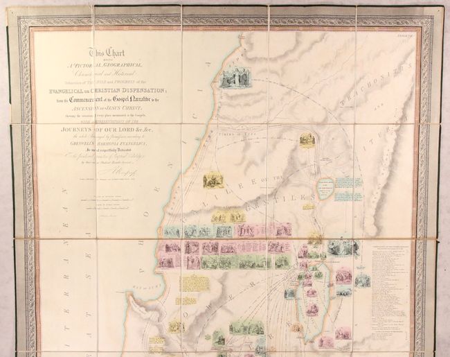
“This Chart Being a Pictorial, Geographical, Chronological and Historical Delineation of the Rise and Progress of the Evangelical or Christian Dispensation...”
Map Maker:
R. Mimpriss
This large, uncommon, and information-packed map o... (full text available to subscribers)
| Item Detail |
| |
| |
MapMaker: |
R. Mimpriss
|
|
| |
| |
Subject: |
Holy Land |
|
| |
Period/Size: |
1833 / 68.0" x 36.0" (172.8 x 91.5 cm)
|
|
| |
Color: |
Colored
|
|
| |
Condition: |
(B+) There are faint stains, a couple horizontal strips of light toning, and minor offsetting. The slipcase is lightly soiled and worn around the edges. (condition help) |
|
| |
Source: |
|
|
| |
References: |
|
|
| |
|
|
| Sales Information |
| |
| |
Price: |
|
|
| |
| |
Offered by: |
Old World Auctions |
|
| |
Catalog: |
Auction No. 180 - Antique Maps, Charts, Atlases & Globes (9526) |
|
| |
Lot/Item #: |
643 |
|
| |
| |
Date: |
11/2020
|
|
| |
| |
|
Antique Maps - Valuation and Pricing, Descriptions, Resources |
|
Home |
Information |
Search |
Register |
Contact Us |
Site Map
Americana Exchange, Inc. © 1999 - 2024 Americana Exchange, Inc.. All rights reserved.
OldMaps.com, the OldMaps.com logo and
AMPR are service marks or registered service marks of Americana Exchange, Inc..
|