Title:
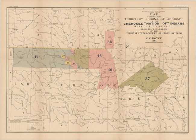
“Map Showing the Territory Originally Assigned to the Cherokee "Nation of" Indians West of the Mississippi. Also the Boundaries of the Territory Now Occupied or Owned by Them”
Map Maker:
Charles C. Royce
This large map depicts, by coloring and numeric ke... (full text available to subscribers)
| Item Detail |
| |
| |
MapMaker: |
Charles C. Royce
|
|
| |
| |
Subject: |
South Central United States, Oklahoma |
|
| |
Period/Size: |
1884 / 20.6" x 29.9" (52.4 x 76.0 cm)
|
|
| |
Color: |
Colored
|
|
| |
Condition: |
(B+) Issued folding with all folds reinforced with paper on verso, closing some fold separations. There is light toning and color offsetting. (condition help) |
|
| |
Source: |
Bureau of Ethnology Fifth Annual Report Pl. IX |
|
| |
References: |
|
|
| |
|
|
| Sales Information |
| |
| |
Price: |
|
|
| |
| |
Offered by: |
Old World Auctions |
|
| |
Catalog: |
Auction No. 180 - Antique Maps, Charts, Atlases & Globes (9526) |
|
| |
Lot/Item #: |
179 |
|
| |
| |
Date: |
11/2020
|
|
| |
| |
|
Antique Maps - Valuation and Pricing, Descriptions, Resources |
|
Home |
Information |
Search |
Register |
Contact Us |
Site Map
Americana Exchange, Inc. © 1999 - 2024 Americana Exchange, Inc.. All rights reserved.
OldMaps.com, the OldMaps.com logo and
AMPR are service marks or registered service marks of Americana Exchange, Inc..
|