| Item Detail |
| |
| |
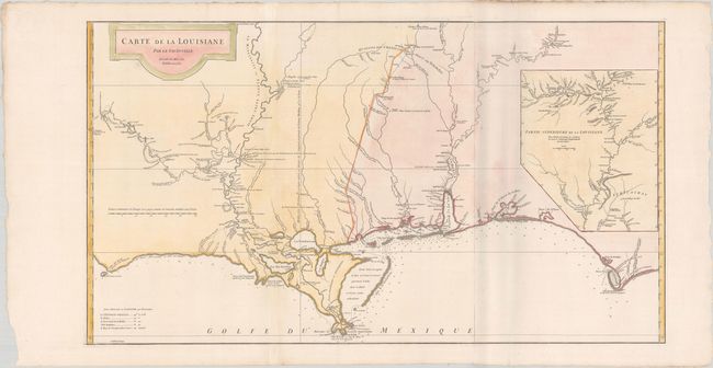
MapMaker: |
Jean Baptiste Bourguignon d'Anville
|
|
| |
| |
Subject: |
Colonial Southern United States |
|
| |
Period/Size: |
1752 / 20.4" x 36.4" (51.9 x 92.5 cm)
|
|
| |
Color: |
Colored
|
|
| |
Condition: |
(A) A crisp impression on bright sheets with light toning, soiling and chipping only along the edges of the sheets. The paper is otherwise very strong and supple. There are some light shadows along the right-hand fold that are caused by our scanner and (condition help) |
|
| |
Source: |
|
|
| |
References: |
Phillips (Atlases) #571-35; Lemmon, Magill & Wiese #24. |
|
| |
|
|
| Sales Information |
| |
| |
Price: |
|
|
| |
| |
Offered by: |
Old World Auctions |
|
| |
Catalog: |
Auction No. 180 - Antique Maps, Charts, Atlases & Globes (9526) |
|
| |
Lot/Item #: |
176 |
|
| |
| |
Date: |
11/2020
|
|
| |
| |
|