| Item Detail |
| |
| |
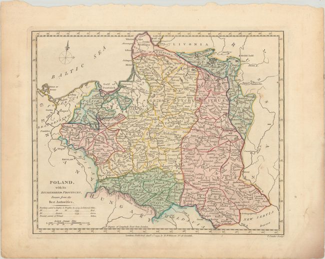
MapMaker: |
Robert Wilkinson
|
|
| |
| |
Subject: |
Eastern Europe, Poland |
|
| |
Period/Size: |
1794 / 8.5" x 10.5" (21.6 x 26.7 cm)
|
|
| |
Color: |
Colored
|
|
| |
Condition: |
(B+) Full contemporary color on a sheet with a "1794 J. Whatman" watermark, very light soiling, a few spots of foxing, and damp stains confined to the blank margins. (condition help) |
|
| |
Source: |
|
|
| |
References: |
|
|
| |
|
|
| Sales Information |
| |
| |
Price: |
|
|
| |
| |
Offered by: |
Old World Auctions |
|
| |
Catalog: |
Auction No. 180 - Antique Maps, Charts, Atlases & Globes (9526) |
|
| |
Lot/Item #: |
538 |
|
| |
| |
Date: |
11/2020
|
|
| |
| |
|