Title:
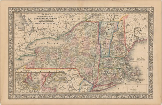
“County Map of the States of New York, New Hampshire, Vermont. Massachusetts, Rhode Id. and Connecticut”
Map Maker:
Samuel Augustus Mitchell
Bordered by Canada in the East and West, Maine, Pe... (full text available to subscribers)
| Item Detail |
| |
| |
MapMaker: |
Samuel Augustus Mitchell
|
|
| |
| |
Subject: |
New England - United States |
|
| |
Period/Size: |
1860 / 13.4" x 21.3" (34.1 x 54.1 cm)
|
|
| |
Color: |
Colored
|
|
| |
Condition: |
(A) Original color with light toning along the edges of the sheet. (condition help) |
|
| |
Source: |
|
|
| |
References: |
|
|
| |
|
|
| Sales Information |
| |
| |
Price: |
|
|
| |
| |
Offered by: |
Old World Auctions |
|
| |
Catalog: |
Auction No. 180 - Antique Maps, Charts, Atlases & Globes (9526) |
|
| |
Lot/Item #: |
154 |
|
| |
| |
Date: |
11/2020
|
|
| |
| |
|
Antique Maps - Valuation and Pricing, Descriptions, Resources |
|
Home |
Information |
Search |
Register |
Contact Us |
Site Map
Americana Exchange, Inc. © 1999 - 2024 Americana Exchange, Inc.. All rights reserved.
OldMaps.com, the OldMaps.com logo and
AMPR are service marks or registered service marks of Americana Exchange, Inc..
|