| Item Detail |
| |
| |
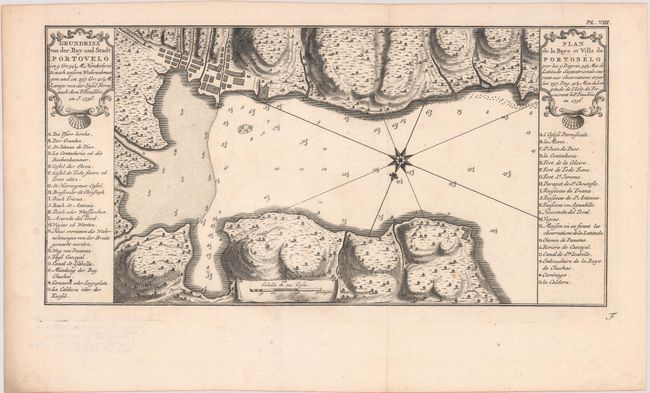
MapMaker: |
Antonio de Ulloa
|
|
| |
| |
Subject: |
Portobelo, Panama |
|
| |
Period/Size: |
1752 / 7.1" x 14.2" (18.1 x 36.1 cm)
|
|
| |
Color: |
Black & White
|
|
| |
Condition: |
(A) A crisp impression, issued folding on a sheet with a bunch of grapes watermark and a few minor spots of foxing. (condition help) |
|
| |
Source: |
Illustrations de Voyage Historique de l'Amérique Méridionale |
|
| |
References: |
Kapp (MCC-73) #73; cf. Shirley (BL Atlases) G.ULL-1a. |
|
| |
|
|
| Sales Information |
| |
| |
Price: |
|
|
| |
| |
Offered by: |
Old World Auctions |
|
| |
Catalog: |
Auction No. 181 - Antique Maps, Charts, Atlases & Globes (9527) |
|
| |
Lot/Item #: |
329 |
|
| |
| |
Date: |
02/2021
|
|
| |
| |
|