| Item Detail |
| |
| |
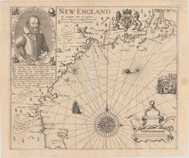
MapMaker: |
John Smith
|
|
| |
| |
Subject: |
Colonial New England United States |
|
| |
Period/Size: |
1617 / 11.5" x 13.6" (29.3 x 34.6 cm)
|
|
| |
Color: |
Black & White
|
|
| |
Condition: |
(A) A crisp impression issued folding, now flat, with minor toning and soiling and a small hole at center that has been expertly repaired on verso. (condition help) |
|
| |
Source: |
|
|
| |
References: |
Burden #190; McCorkle #617.1; cf. Deak #19; cf. Fite & Freeman #34; cf. Pritchard & Taliaferro #6. |
|
| |
|
|
| Sales Information |
| |
| |
Price: |
|
|
| |
| |
Offered by: |
Old World Auctions |
|
| |
Catalog: |
Auction No. 181 - Antique Maps, Charts, Atlases & Globes (9527) |
|
| |
Lot/Item #: |
157 |
|
| |
| |
Date: |
02/2021
|
|
| |
| |
|