Title:
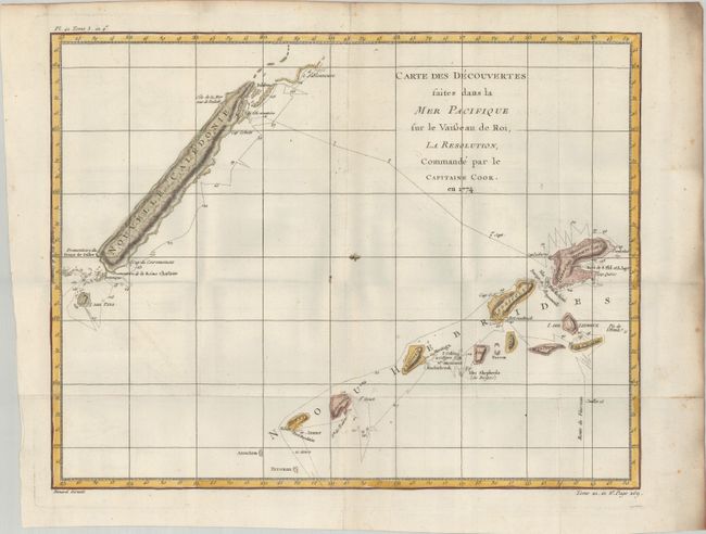
“Carte des Decouvertes Faites dans la Mer Pacifique sur le Vaisseau de Roi, la Resolution, Commande par le Capitaine Cook, en 1774”
Map Maker:
Cook/Benard
A delicately engraved exploration chart that detai... (full text available to subscribers)
| Item Detail |
| |
| |
MapMaker: |
Cook/Benard
|
|
| |
| |
Subject: |
New Caledonia & New Hebrides |
|
| |
Period/Size: |
1778 / 14.1" x 18.3" (35.9 x 46.5 cm)
|
|
| |
Color: |
Colored
|
|
| |
Condition: |
(A) A crisp impression, issued folding on a bright sheet with a small medallion watermark and soiling along the edges of the sheet. There are grayish shadows in the image that are caused by our scanner and do not appear on the map itself. (condition help) |
|
| |
Source: |
Histoire Generale des Voyages |
|
| |
References: |
|
|
| |
|
|
| Sales Information |
| |
| |
Price: |
|
|
| |
| |
Offered by: |
Old World Auctions |
|
| |
Catalog: |
Auction No. 181 - Antique Maps, Charts, Atlases & Globes (9527) |
|
| |
Lot/Item #: |
698 |
|
| |
| |
Date: |
02/2021
|
|
| |
| |
|
Antique Maps - Valuation and Pricing, Descriptions, Resources |
|
Home |
Information |
Search |
Register |
Contact Us |
Site Map
Americana Exchange, Inc. © 1999 - 2024 Americana Exchange, Inc.. All rights reserved.
OldMaps.com, the OldMaps.com logo and
AMPR are service marks or registered service marks of Americana Exchange, Inc..
|