| Item Detail |
| |
| |
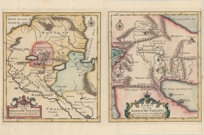
MapMaker: |
P. Starckman
|
|
| |
| |
Subject: |
Middle East |
|
| |
Period/Size: |
1725 / 9.2" x 8.2" (23.4 x 20.9 cm)
|
|
| |
Color: |
Colored
|
|
| |
Condition: |
(A) Crisp impressions on bright sheets with the watermarks of "Beavuais" on one sheet and a coat of arms on the other. The second sheet has an extraneous crease at left and a narrow right margin. The first image is a composite image - the maps are on tw (condition help) |
|
| |
Source: |
Het Algemeen Groot Historisch, Oordeelkundig, Chronologisch, Geografisch ... van |
|
| |
References: |
|
|
| |
|
|
| Sales Information |
| |
| |
Price: |
|
|
| |
| |
Offered by: |
Old World Auctions |
|
| |
Catalog: |
Auction No. 181 - Antique Maps, Charts, Atlases & Globes (9527) |
|
| |
Lot/Item #: |
579 |
|
| |
| |
Date: |
02/2021
|
|
| |
| |
|