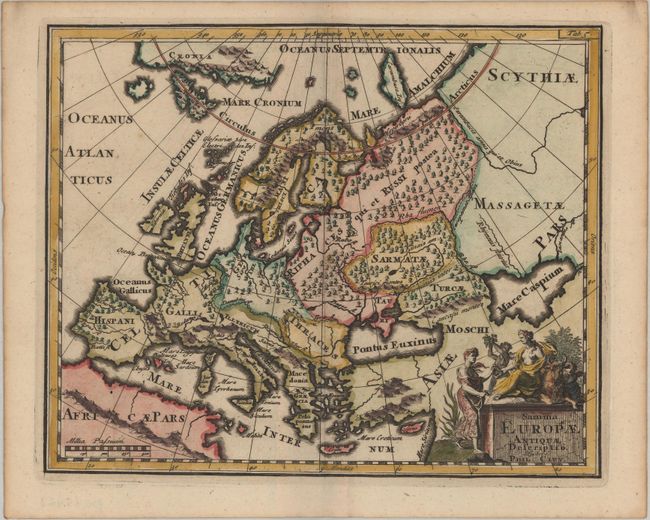
Title:
“Summa Europae Antiquae Descriptio”
Map Maker:
Philipp Cluver
This map of Europe shows its ancient divisions, as... (full text available to subscribers)
| Item Detail |
| |
| |
MapMaker: |
Philipp Cluver
|
|
| |
| |
Subject: |
Europe |
|
| |
Period/Size: |
1697 / 8.1" x 9.9" (20.6 x 25.2 cm)
|
|
| |
Color: |
Colored
|
|
| |
Condition: |
(A) A dark impression with light toning along the edges of the sheet. (condition help) |
|
| |
Source: |
Introductio in Universam Geographicam |
|
| |
References: |
Shirley (BL Atlases) T.CLUV-8a #2. |
|
| |
|
|
| Sales Information |
| |
| |
Price: |
|
|
| |
| |
Offered by: |
Old World Auctions |
|
| |
Catalog: |
Auction No. 181 - Antique Maps, Charts, Atlases & Globes (9527) |
|
| |
Lot/Item #: |
396 |
|
| |
| |
Date: |
02/2021
|
|
| |
| |
|
Antique Maps - Valuation and Pricing, Descriptions, Resources |
|
Home |
Information |
Search |
Register |
Contact Us |
Site Map
Americana Exchange, Inc. © 1999 - 2024 Americana Exchange, Inc.. All rights reserved.
OldMaps.com, the OldMaps.com logo and
AMPR are service marks or registered service marks of Americana Exchange, Inc..
|